Listeners:
Top listeners:
-
 play_arrow
The Canadianist Radio Listen. Watch. Read. Discuss. We're in the middle of everything.
-
 play_arrow
Canadianism Podcast | S2 E7 | Quebec Is About to Show Canada What’s Wrong With Our Voting System
SUBSCRIBE NOW TO OUR MAILING LIST

10 Places You Have to Stand Once in Your Life to See Canada at Its Finest
10 Places You Have to Stand Once in Your Life to See Canada at Its Finest
Canada is ridiculously beautiful.
We say that so often that it’s almost become a cliché, but every once in a while you find yourself standing somewhere in this country that reminds you exactly why we say it.
Not looking at a picture of it. Not flying over it. Actually standing there.
There’s a moment when you reach the edge of a mountain, walk out onto a beach or look across a lake and realize that you’re seeing something that simply doesn’t exist anywhere else quite like this.
So this isn’t a list of Canada’s ten best tourist attractions. It’s not even necessarily a list of Canada’s ten most beautiful destinations.
These are 10 places to stand.
Ten spots where you can plant your feet, look around and see Canada at its absolute finest.
And yes, we’re going to argue about the list. That’s half the fun.
10. Prospect Point, Stanley Park, British Columbia
Vancouver sometimes feels as though someone cheated when they designed it.
You have a major city squeezed between the Pacific Ocean and the Coast Mountains, with an enormous temperate rainforest sitting right beside downtown.
Prospect Point in Stanley Park is one of the places where it all comes together.
Stand at the lookout and you’ve got Burrard Inlet below, the Lions Gate Bridge stretching across the water, the North Shore mountains rising behind it and Stanley Park surrounding you.
It’s not Canada’s wildest view. That’s exactly why it belongs here.
This is Canada demonstrating that wilderness and a major city don’t necessarily have to live hundreds of kilometres apart.
Stand here: Prospect Point Lookout
Coordinates: 49.313489, -123.142438
Getting there: Easy. Drive, cycle or travel through Stanley Park and walk to the lookout.
Open Prospect Point in Google Maps
9. Greenwich Dunes, Prince Edward Island
Not every great Canadian view needs a mountain.
Sometimes Canada is red earth, marram grass blowing in the wind, enormous dunes and the Gulf of St. Lawrence disappearing into the horizon.
That’s Greenwich.
The journey is part of the view. The Greenwich Dunes Trail runs across old fields and through forest before carrying you over Bowley Pond on a floating boardwalk. Then the landscape opens up and the dunes appear.
Prince Edward Island National Park describes the trail as 4.6 kilometres one way and rates it moderate. There are some stairs and steeper sections around the dunes.
It’s quiet, unmistakably Maritime and completely different from almost everything else on this list.
Stand here: Greenwich Dunes Trail
Coordinates: 46.443958, -62.694117
Getting there: Moderate. These coordinates are the Parks Canada trailhead; the great view comes after you’ve earned it.
Open Greenwich Dunes in Google Maps
8. Signal Hill, St. John’s, Newfoundland and Labrador
This one gives you two Canadas at once.
Stand on Signal Hill and look one way toward St. John’s, its colourful houses, harbour and one of the oldest urban landscapes on the continent.
Then turn around.
Atlantic Ocean.
Nothing subtle about it.
The Narrows below you form the entrance to St. John’s Harbour, and suddenly the geography explains the city. You understand why people settled here and why this little opening in the Newfoundland coast mattered so much.
Parks Canada places Signal Hill at 230 Signal Hill Road, and you can drive essentially right up to this one.
Stand here: Cabot Tower, Signal Hill
Coordinates: 47.570014, -52.681775
Getting there: Easy. This is one of the most accessible spectacular views on our list.
Open Signal Hill in Google Maps
7. Percé, Quebec
There are landscapes that look pretty.
Then there are landscapes that have a centrepiece.
Percé has one hell of a centrepiece.
Rocher Percé rises out of the Gulf of St. Lawrence like somebody deliberately put it there. The enormous limestone formation, its natural arch, the sea, the Gaspé coastline and nearby Bonaventure Island combine into one of the most instantly recognizable landscapes in Quebec.
The spot we’re sending you to is around Mont-Joli in Percé, giving you the classic elevated perspective over the coast and toward the rock.
And this is an important distinction: look at Percé Rock. Don’t decide you’re going to climb it.
The rock itself is protected and unstable. The view is what we’re here for.
Stand here: Mont-Joli area, Percé
Coordinates: 48.523222, -64.212025
Getting there: Easy to moderate depending on the precise lookout you choose once you’re there.
Open the Percé viewpoint area in Google Maps
6. Table Rock, Niagara Falls, Ontario
Yes, Niagara Falls.
I know.
You’ve seen it on postcards. You’ve seen it in movies. You’ve probably seen somebody’s honeymoon pictures from 1977.
Doesn’t matter.
Stand beside Horseshoe Falls.
Actually stand there.
The sheer volume of water moving past you and disappearing over that edge is something photographs simply don’t communicate. You don’t merely see Niagara Falls. You hear it and feel it.
Table Rock puts you almost ridiculously close to the brink of the Canadian Horseshoe Falls. The viewpoint is also wheelchair accessible.
Forget the wax museums and everything blinking a few blocks away for a minute. The waterfall itself remains extraordinary.
Stand here: Table Rock, Canadian Horseshoe Falls
Coordinates: 43.078960, -79.078160
Getting there: Very easy. This is the most accessible location on the list.
Open Table Rock in Google Maps
5. Long Beach, Pacific Rim National Park Reserve, British Columbia
Here’s another Canadian view that doesn’t need elevation.
Stand on Long Beach on Vancouver Island and look west.
That’s it.
Pacific Ocean.
Behind you is the lush coastal environment of Vancouver Island. In front of you is a horizon that seems impossibly far away. Waves roll onto a beach that feels enormous, and depending on the weather, the place can move from peaceful to wonderfully moody in minutes.
British Columbia’s official geographical-names database places the approximate centre of Long Beach at 49°02’59″N, 125°43’04″W.
This is Canada facing the Pacific.
Stand here: Long Beach, Pacific Rim National Park Reserve
Coordinates: 49.049722, -125.717778
Getting there: Easy. There are established access points from the Pacific Rim Highway.
Open Long Beach in Google Maps
4. Skyline Trail, Cape Breton Highlands, Nova Scotia
This is the one that makes you understand why people won’t shut up about the Cabot Trail.
You walk across the Cape Breton Highlands and eventually the land falls away in front of you.
There’s the Gulf of St. Lawrence.
There’s the headland.
And way below you is the Cabot Trail curling around the side of the mountain.
Parks Canada says the main Skyline route is suitable for most skill levels. The return route is 6.5 kilometres and generally takes two to three hours. The final viewing area includes a boardwalk with steps, and the cliffs demand some respect.
If you can catch it near sunset, you’ll understand why this place made the list.
Stand here: Skyline Trail, Cape Breton Highlands National Park
Coordinates: 46.737691, -60.880377
Getting there: Easy hike, but it’s still a hike. Allow two to three hours.
Open Skyline Trail in Google Maps
3. King’s Throne, Kluane National Park and Reserve, Yukon
Now we’re getting serious.
Kathleen Lake below you. Mountains in seemingly every direction. Huge Yukon sky. Almost nothing around you that looks remotely interested in accommodating civilization.
King’s Throne is the Canada of enormous spaces.
And unlike Niagara, you’re going to work for this one.
Parks Canada says it’s a 10-kilometre return trip just to reach the cirque, with 548 metres of elevation gain. Continuing toward the summit turns it into a 16-kilometre trip with 1,442 metres of elevation gain, and the route beyond the maintained trail is unmarked and unmaintained.
So we’re not casually telling anyone to wander up a Yukon mountain. The maintained route to the cirque already provides the payoff.
This is wilderness. Treat it accordingly.
Stand here: King’s Throne Trail, overlooking Kathleen Lake
Coordinates: 60.575278, -137.304167
Getting there: Difficult. The coordinate identifies the Kathleen Lake area; use the signed King’s Throne/Cottonwood trailhead and current Parks Canada route information rather than navigating cross-country toward a pin.
Open Kathleen Lake and King’s Throne area in Google Maps
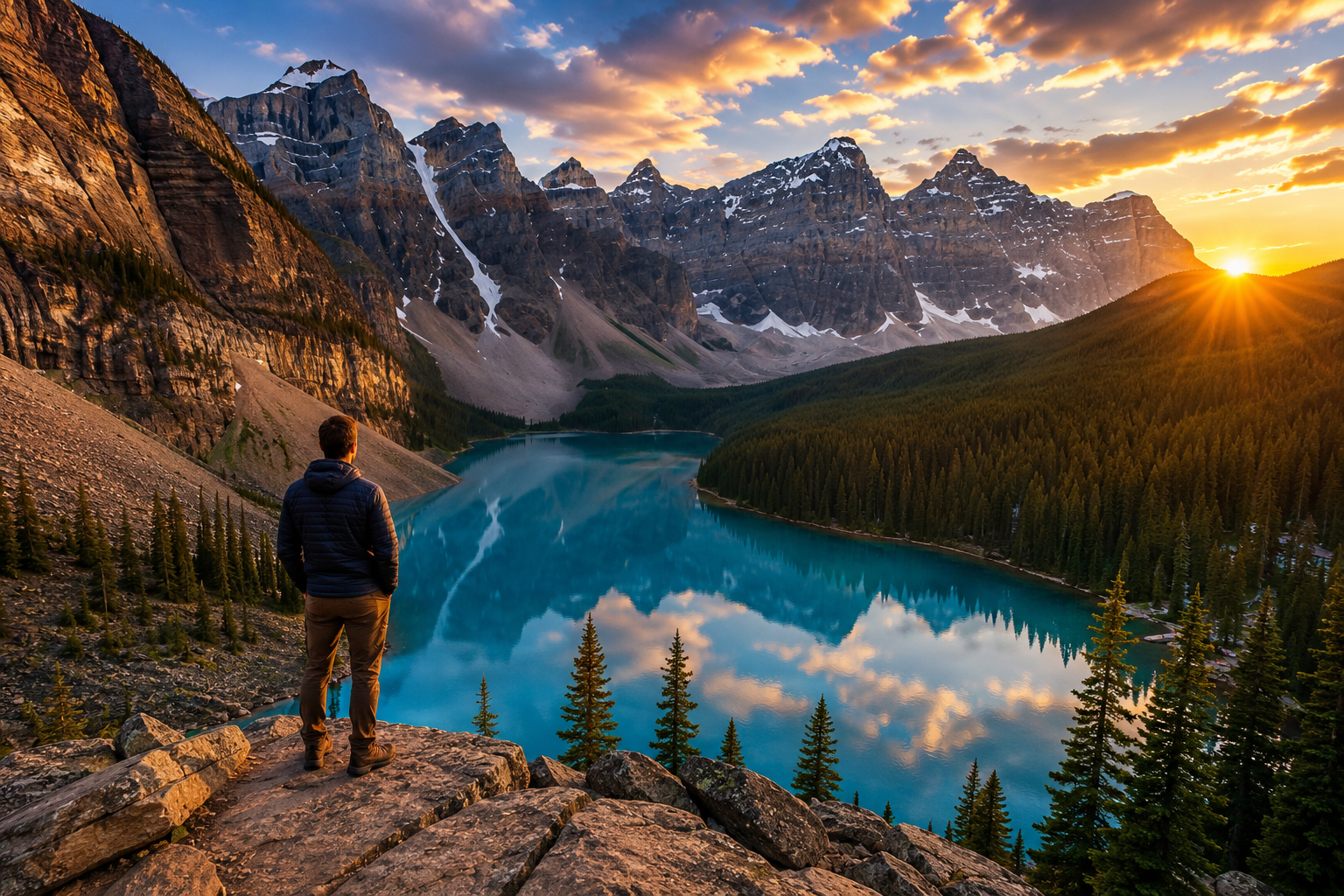
2. Moraine Lake, Banff National Park, Alberta
There was a time when Canadians could see this image every time they pulled a twenty-dollar bill out of their wallet.
There’s a reason.
Moraine Lake beneath the Valley of the Ten Peaks may be the most stereotypically Canadian view imaginable, except the stereotype happens to be real.
That water.
Those mountains.
The trees.
The enormous wall of rock surrounding an impossibly blue lake.
And here’s the strange part: you’ve seen this view so many times that you might expect the real thing to be disappointing.
It isn’t.
The classic perspective is from the Rockpile above the lake. Access to Moraine Lake is tightly managed and personal vehicles generally aren’t how visitors get there anymore, so check the current Parks Canada transportation arrangements before heading out.
Stand here: Rockpile viewpoint, Moraine Lake
Coordinates: 51.3217, -116.1860
Getting there: The viewpoint itself is a short walk once you’ve reached Moraine Lake; getting to the lake requires planning.
Open Moraine Lake in Google Maps
1. Western Brook Pond, Gros Morne National Park, Newfoundland and Labrador
This is it.
If somebody landed in Canada tomorrow and asked me to show them one view that demonstrates just how spectacular this country can be, Western Brook Pond would be awfully difficult to beat.
Billion-year-old cliffs rise around a glacier-carved gorge. Waterfalls drop from the plateau roughly 2,000 feet above and can turn into mist before they even reach the water.
And then there’s that view.
The famous perspective from high above Western Brook Pond looks down through the gorge as the water snakes between enormous cliffs toward the distance.
It barely looks real.
But there’s an enormous asterisk beside this one.
The famous high viewpoint is not the ordinary Western Brook Pond walking trail.
The standard trail from the parking area to the pond is about three kilometres one way, mostly flat and firm, and Parks Canada has worked to make much of it accessible. The iconic elevated view is a serious backcountry undertaking. Parks Canada notes that reaching the North Rim viewpoint involves wilderness navigation and a roughly 600-metre ascent, and recommends it for experienced hikers. Guided options are available for the gorge hike.
So don’t punch a photograph into your phone and start climbing toward it.
Plan this one properly.
For everyone else, the trail, boat tour and views from water level are spectacular in their own right.
Stand here: Western Brook Pond, Gros Morne National Park
Coordinates: 49.71081, -57.62547
Getting there: The regular pond experience is relatively accessible. Reaching the iconic elevated gorge view is a serious backcountry excursion and should be planned accordingly.
Open Western Brook Pond in Google Maps
Now You Get to Tell Us We’re Wrong
That’s our ten.
From Newfoundland cliffs to Yukon mountains, Quebec’s Gaspé coast, an Ontario waterfall, PEI dunes, Cape Breton headlands, Vancouver Island’s Pacific shore and those almost absurdly beautiful Alberta Rockies.
But Canada is enormous, which means somebody is already yelling, “How the hell did you leave THAT off the list?”
Good.
That’s what the comments are for.
Should Lake Louise be here? Peyto Lake? Georgian Bay? Hopewell Rocks? Algonquin in October? The Thousand Islands? Mount Robson? Somewhere in the Laurentians? Somewhere in the Arctic that makes everything on this list look ordinary?
What’s the single most beautiful place you’ve ever stood in Canada?
Tell me in the comments down below. And if there’s somewhere we’ve missed that absolutely deserves to be here, tell us exactly where it is.
We may have to make another ten.


Top popular






Post comments (0)